The project- “DEVELOPING A WEB-GIS BASED EARLY WARNING SYSTEM FOR THE COMMUNITIES LIVING WITH LANDSLIDE RISKS IN CHITTAGONG METROPOLITAN AREA, BANGLADESH” was lead by the BUET-Japan Institute of Disaster Prevention and Urban Safety (BUET-JIDPUS), Bangladesh University of Engineering and Technology (BUET), Dhaka, Bangladesh.
This project was funded by SERVIR, a regional visualization and monitoring system that integrates earth observations such as satellite imagery and forecast models, with in-situ data and other information for timely decision-making. SERVIR is a joint initiative of USAID (United States Agency for International Development) and NASA (National Aeronautics and Space Administration). SERVIR-Himalaya is implemented in partnership with the ICIMOD (International Centre for Integrated Mountain Development) and works towards establishing itself as a regional resource centre in the Hindu Kush Himalayan (HKH) region by developing relevant geospatial applications, and increasing access to data and decision- support tools on different thematic areas.
 Project Duration: June 2014 – December 2015.
Level of Competition
According to ICIMOD, out of the 191 concept papers submitted for consideration, 28 were shortlisted. The shortlisted applicants expanded their concept papers into complete proposals, which went through a second round of rigorous evaluation. Finally, 8 proposals (i.e. including BUET-JIDPUS) were selected for funding. The concept paper and the final proposal was primarily written by Bayes Ahmed as part of his PhD thesis at UCL IRDR.
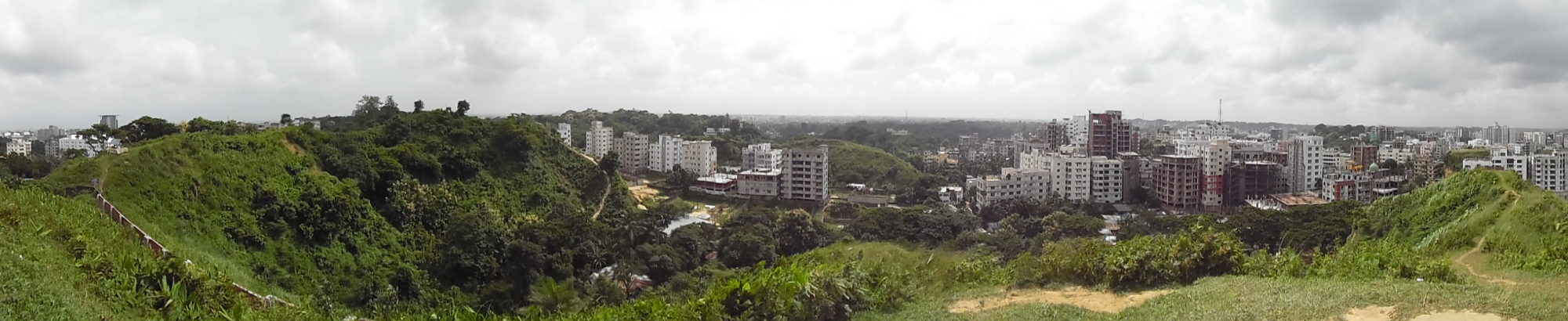
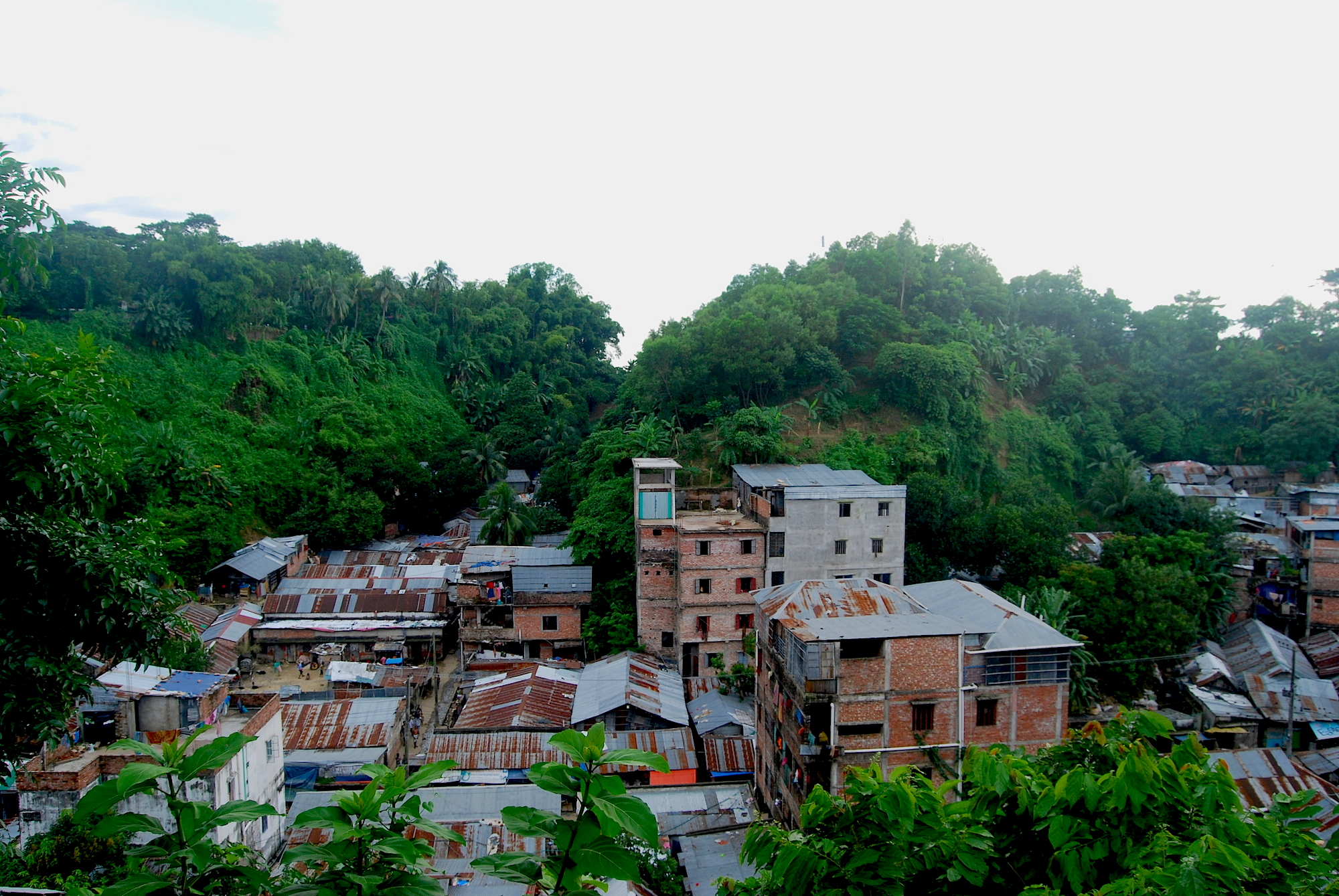
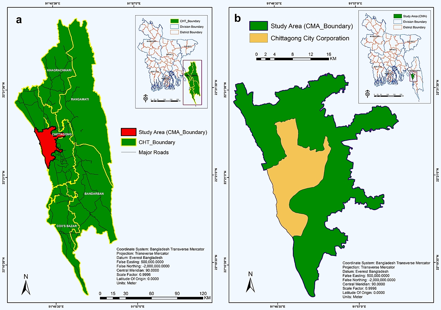
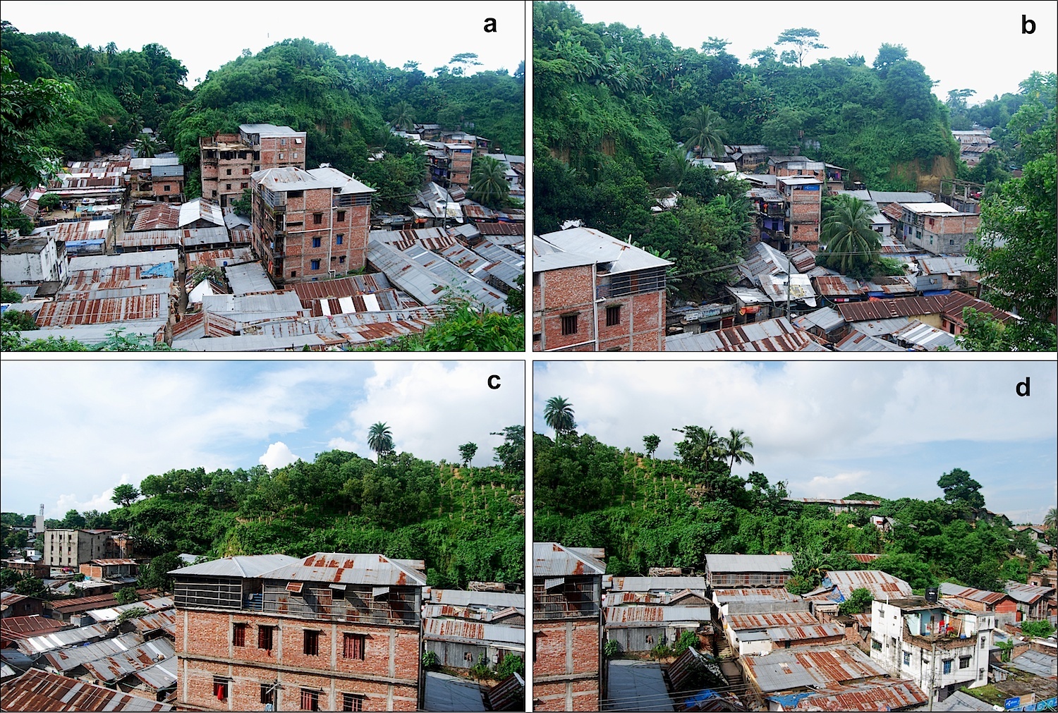
Study Area: Chittagong Metropolitan Area (CMA), Bangladesh
 Source: Bayes Ahmed. (2014). Landslide susceptibility mapping using multi-criteria evaluation techniques in Chittagong Metropolitan Area, Bangladesh. Landslides (Springer Berlin Heidelberg).
![]()